
North Fork Big Thompson River Restoration at Glen Haven
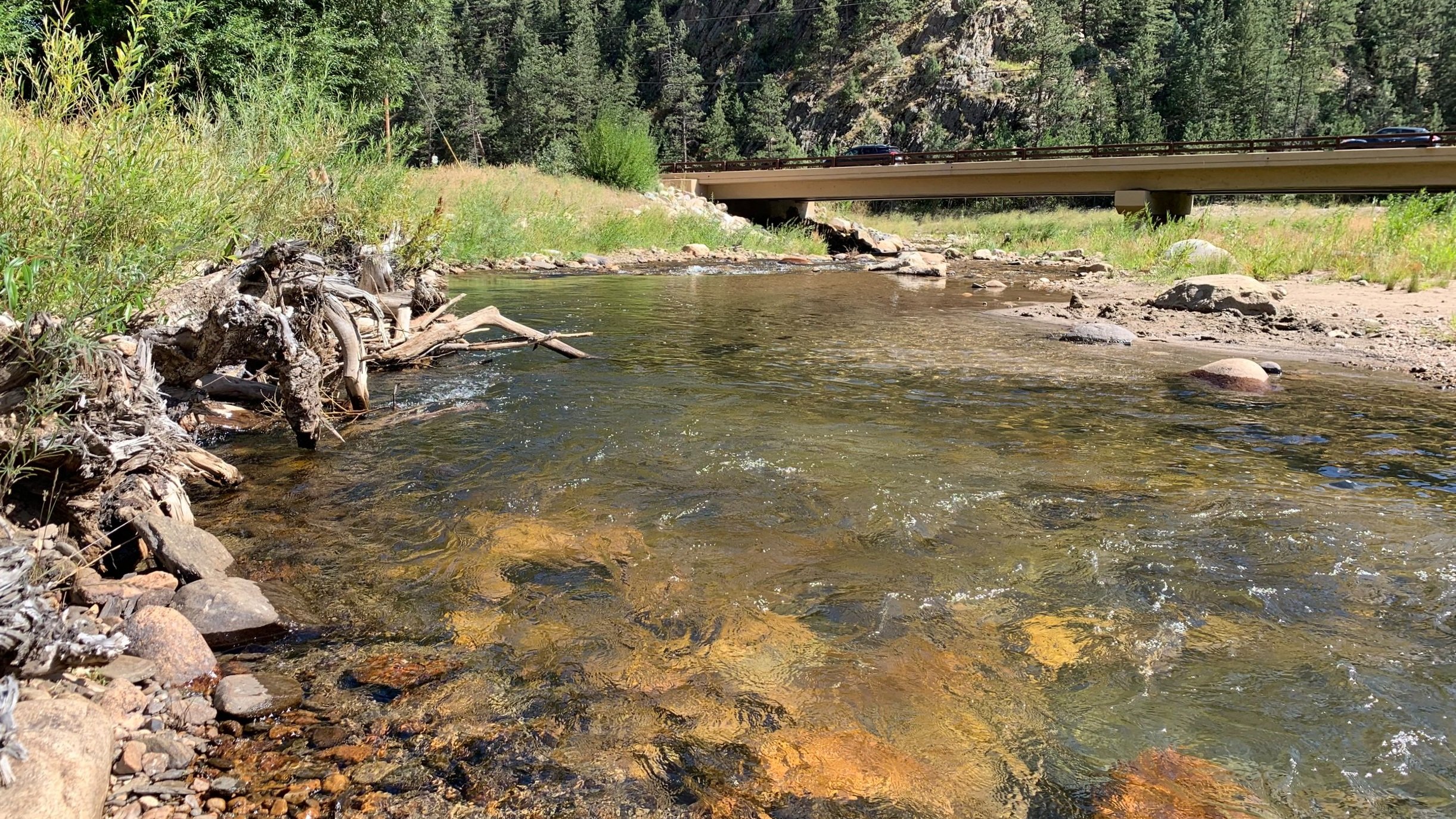
The North Fork project is located at the confluence of the North Fork and main stem of the Big Thompson River near the Town of Drake.
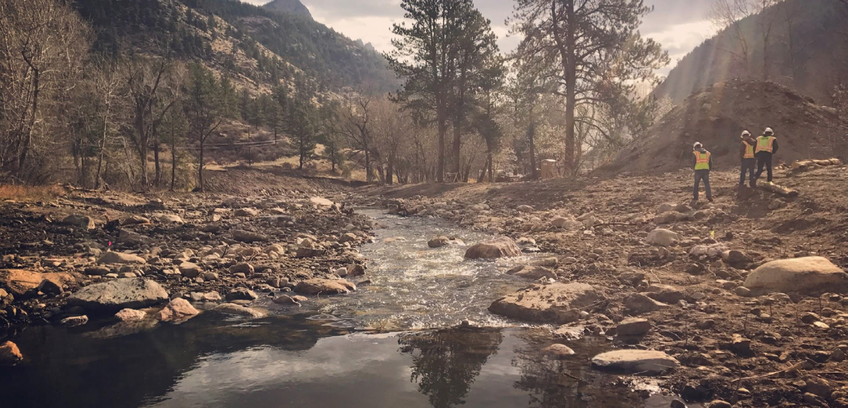
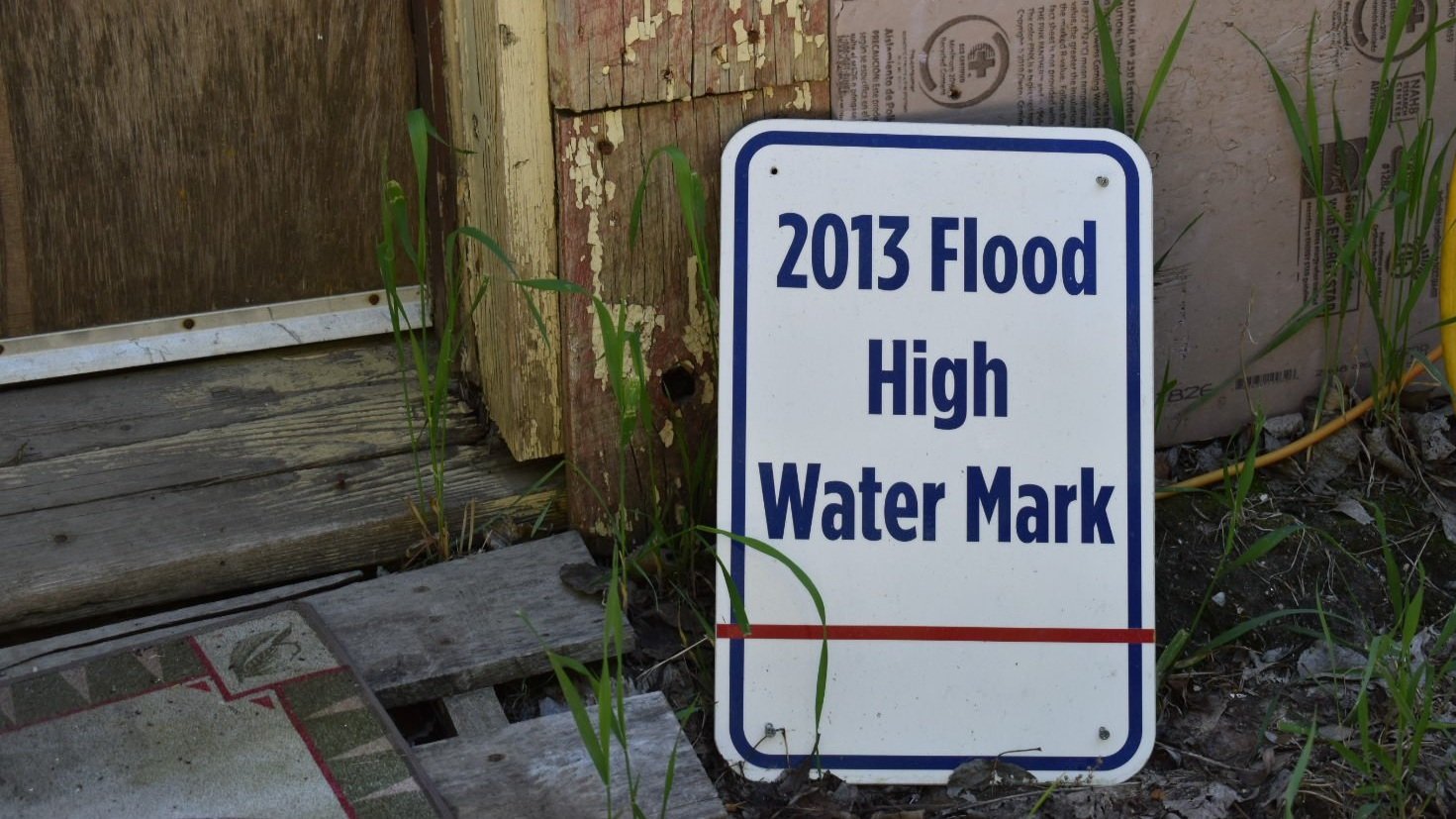
Set in a natural opening in the canyon, the North Fork reclaimed historic channel pathways and deposited large quantities of sediment during the 2013 Colorado flood.
Storm Mountain Bridge at the upper project boundary was flanked by flood flows, while the Highway 34 bridge at the downstream end was completely blocked by sediment and debris.
Additionally, public and private infrastructure built within the river corridor, including campground buildings, private residences, a hotel, and a roadway embankment, were damaged by these natural river processes.
Restoring immediate access was a top priority after the flood, but emergency measures executed without a holistic vision left the reach severely degraded and in need of significant additional investment to repair.
In this project, natural channel adjustment of the low-flow and bankfull channels is welcome and even encouraged.
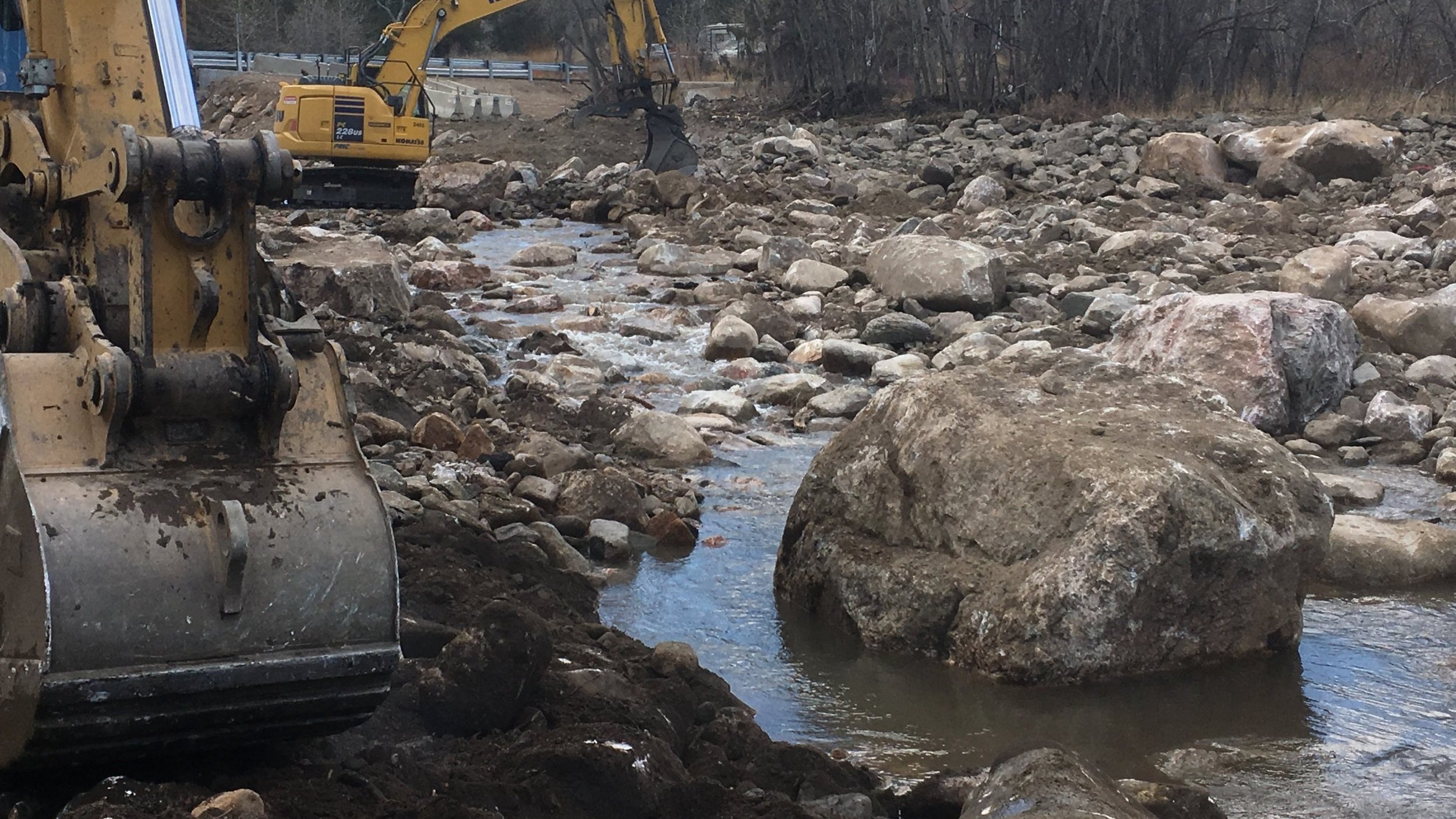
Because large flood flows cannot be contained with the channel, an overflow channel was excavated and guidebanks were added to direct flood flows around critical infrastructure.
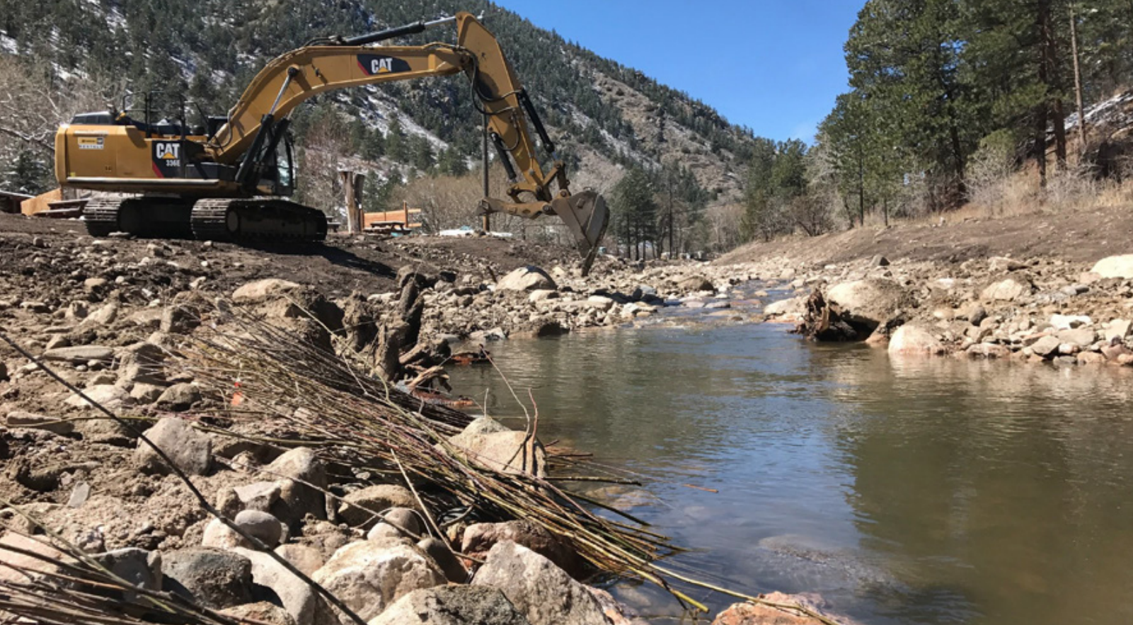
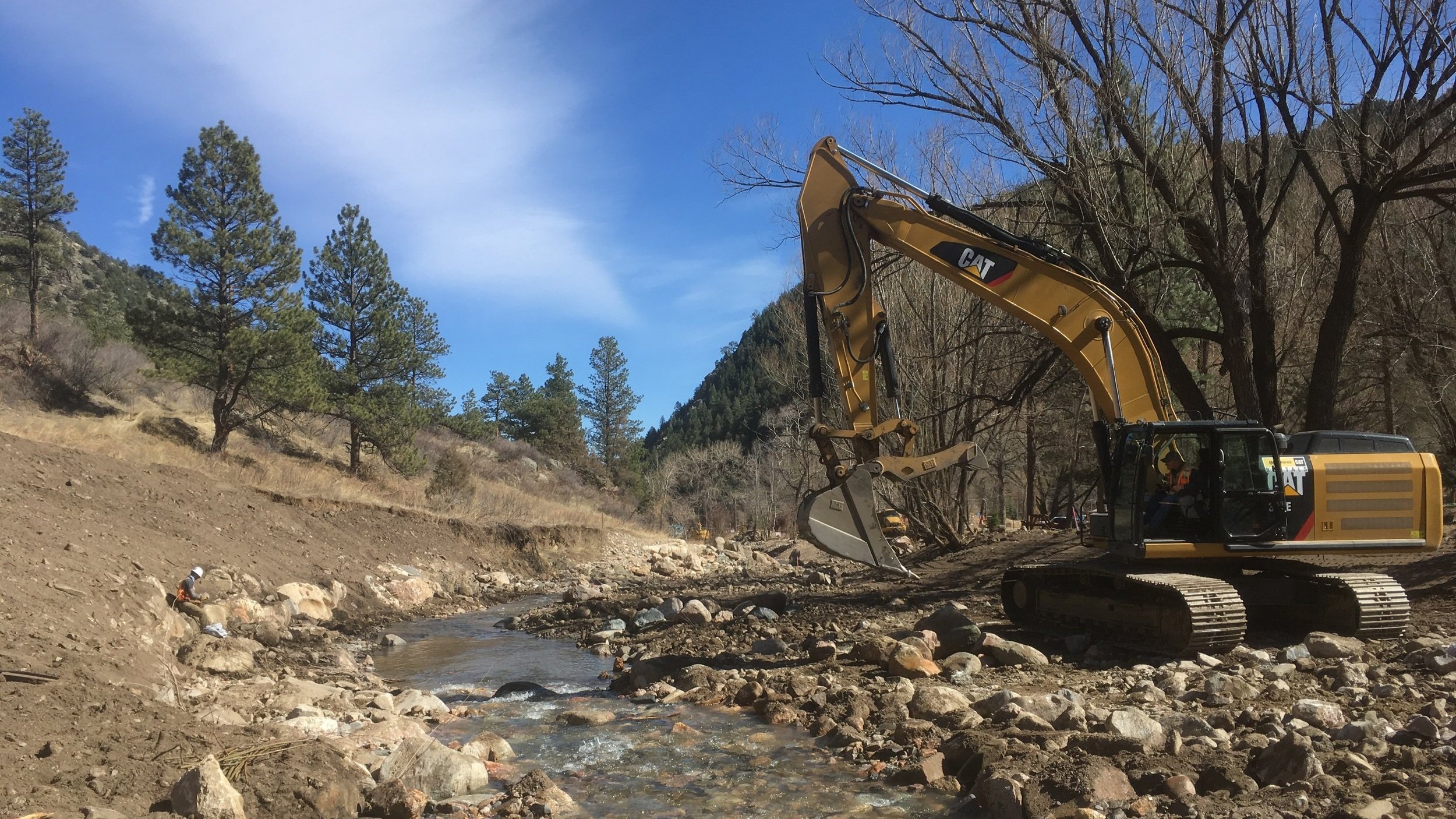
Engineered in-channel structures are designed using native materials that mimic natural bed forms in order to sustain long-term bed stability while replicating natural elements in the system.
Whenever possible, plant materials were incorporated into engineered structures (bioengineering), as the combination of rock and roots will add strength to the structures and provide long-term ecological benefits to the stream.
Large wood was reintroduced into the channel and floodplain to provide habitat complexity and direct erosive energy away from vulnerable stream banks.
PROJECT GOALS
PROTECT LIFE, PROPERTY + INFRASTRUCTURE
Stabilize streambanks to protect against additional damage to existing infrastructure
MITIGATE FLOOD RISK
Increase the capacity of the stream channel and floodplain
IMPROVE WATER QUALITY
Improve water quality through the reduction of sediment loading caused by bank erosion; establish cover on critically eroding land.
ENHANCE ECOSYSTEM STRUCTURE + FUNCTION
Enhance riparian habitat through revegetation. Improve fish habitat through revegetation, improved water quality, and better in-stream habitat complexity
EXPAND RECREATIONAL OPPORTUNITIES, BOLSTER ECONOMIC DEVELOPMENT + ENRICH TOURISM
Create a space that blends into the landscape and feels natural; develop features that encourage participation with the river.
“This reach is looking outstanding! Cascades and pools are functioning really well and the campsite seems to be thriving again...Thank you for bringing this project to life and making it successful. Job well done! ”
— Joe Juergensen, Project Manager

Contact us to see how we can help you with your watershed.